Philly Crash Atlas
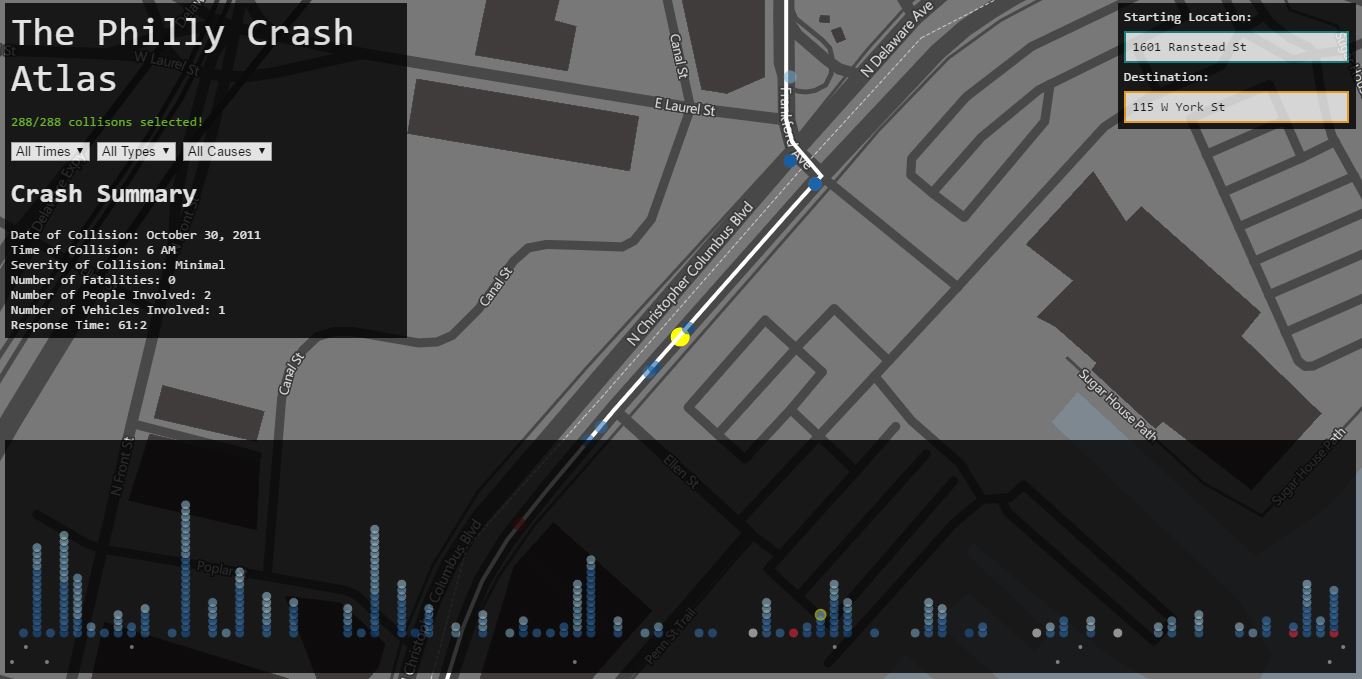
The Philly Crash Atlas was made by myself and a few other students in my Geovisualization class taught by Alan MacEachren. It's purpose is to give commutters an idea of the safety of their daily routes.
-----------------------------------
Archaeological LIDAR Processing in Mexico
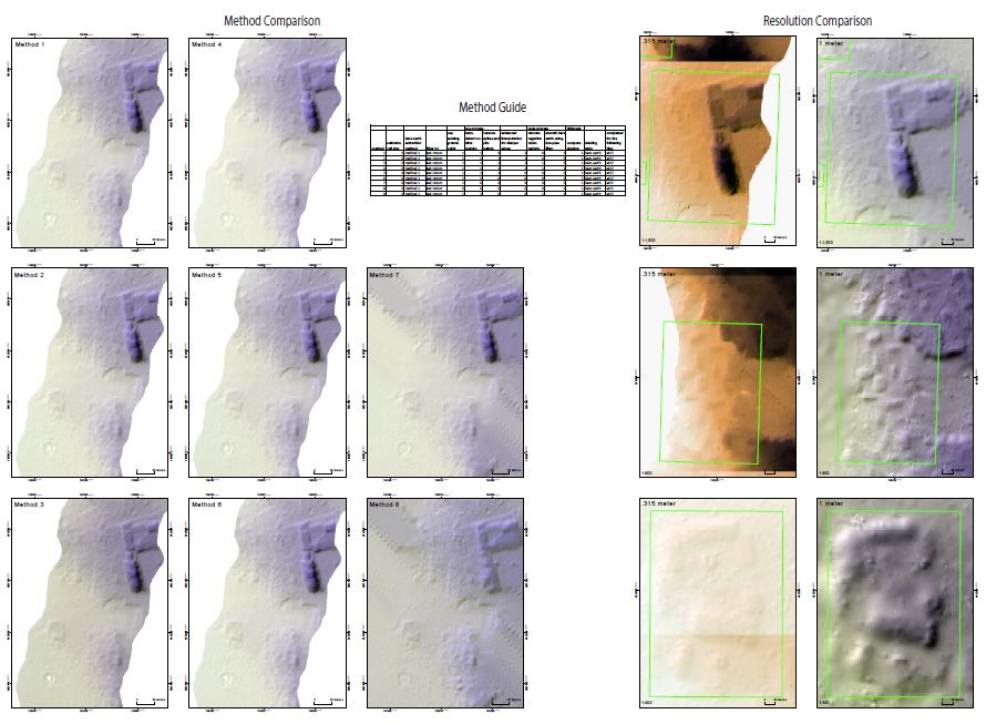
This image shows different processing methods for finding Mayan Artifacts in the Chiapas region of Mexico. With the LIDAR data given, I was tasked to find the LIDAR processing method for exposing subsurface ruins, artifacts, and land changes.
-----------------------------------